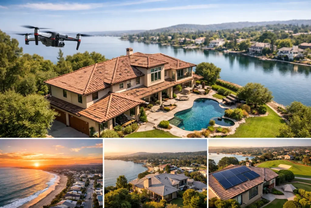
A waterfront view, a corner lot, a walkable location, and a resort-style backyard can disappear in standard eye-level photography. For South Florida agents, “best drone shots listings” is shorthand for a bigger goal: give buyers immediate context before they decide whether a property deserves a showing.
Drone photography is not just a dramatic add-on. Used with purpose, it helps a buyer understand how a home sits on the lot, what surrounds it, and which lifestyle features justify the price. Used without a plan, it can become a collection of attractive but unhelpful overhead images.
The Best Drone Shots for Listings Start With the Story
Every aerial image should answer a buyer question. Is the home close to the beach? Does it have a deep backyard? Is the pool private? How close are neighboring homes, major roads, parks, golf courses, marinas, or downtown amenities?
That is why the first step is not launching the drone. It is identifying the listing’s strongest visual advantage and building the shot plan around it. A modern home in Coconut Grove may need to show mature tree cover, proximity to Biscayne Bay, and the scale of its lot. A Fort Lauderdale waterfront property may need to lead with dockage, canal access, and the relationship between the home and open water. A Palm Beach County estate may sell the approach, acreage, gated entry, and outdoor entertaining areas.
The goal is clarity. Buyers should be able to look at the aerials and quickly understand what makes the property different from the homes they are comparing online.
Show the Property in Its Full Setting
The most valuable drone images usually establish context before they chase drama. A high, straight-down image can clearly define lot lines, roof design, pool placement, driveways, and outdoor living zones. A lower oblique angle gives the home shape and shows how the front elevation, landscaping, and yard work together.
For larger properties, use a sequence rather than a single hero image. Start with a polished front aerial that makes the home feel substantial. Follow it with an overhead view of the backyard or pool. Then add a wider neighborhood image that demonstrates the nearby feature buyers care about most, whether that is a marina, beach access, golf course, park, or city center.
This sequence works because it moves from the property itself to the lifestyle around it. It also prevents a common mistake: showing a beautiful coastline or skyline with no visual connection to the home. If buyers cannot see the property in relation to the amenity, the image may create atmosphere without building value.
Use altitude with intention
Higher is not always better. A very high image can make even a large home look small, while a low flight can hide the scale of the lot. Mid-altitude shots are often the best balance for standard residential listings because they reveal the home, outdoor areas, and immediate surroundings in one frame.
Reserve wider, higher views for properties where location is the primary selling point. Waterfront homes, homes near downtown districts, equestrian properties, and large estates benefit most from this perspective. For a condo or townhome, aerial coverage may be more useful for showing building placement, nearby amenities, and access routes than the individual residence itself.
Capture Lifestyle Without Overselling It
South Florida buyers frequently make decisions based on lifestyle as much as square footage. Drone photography can show the morning view from a bayfront home, the distance from a backyard to the Intracoastal, or the privacy created by a lush tropical canopy. Those details create a stronger emotional case than a generic aerial of a roofline.
Still, the image must remain honest. A shot that makes a home appear directly on the water when it is several blocks away creates the wrong expectation. The same goes for overly tight images that hide a busy road, a commercial property, or close neighboring homes.
Professional listing media should make a property look its best while accurately representing it. That protects your reputation, filters out poorly matched buyers, and leads to more productive showings. Buyers who arrive with a clear picture of the setting are more likely to focus on the home instead of feeling surprised by what the photos left out.
Feature the outdoor spaces buyers cannot see from inside
Aerial photography is especially effective when outdoor features are a major part of the value. Pools, summer kitchens, rooftop terraces, boat docks, guest houses, sports courts, and oversized yards often need a higher perspective to make sense.
One angled aerial can show the relationship between the covered patio, pool deck, lawn, and water view far better than four separate ground-level images. For properties with a dock, show the full dock and the waterway beyond it. If the home has a rooftop terrace, a slightly elevated view can communicate both the entertaining space and the view that comes with it.
Know When Drone Coverage Is Worth the Investment
Not every listing needs extensive aerial coverage. On a small interior condo with limited exterior appeal, a few well-planned images of the building, parking, amenities, and nearby attractions may be enough. Spending the budget on interior photography, a 3D tour, or virtual staging could have a greater impact.
Drone coverage becomes more valuable when the home has a visual advantage that ground photography cannot explain. Consider it a priority for waterfront properties, large lots, gated communities, homes near beaches or golf courses, properties with exceptional outdoor areas, and listings where location drives the price.
It also helps when a listing needs to compete against similar homes. If three nearby properties have comparable square footage and finishes, the one that clearly demonstrates its larger yard, better canal position, or closer beach access has a meaningful advantage in the first few seconds of a buyer’s search.
Plan for Weather, Airspace, and Timing
Aerial media in South Florida depends heavily on conditions. Bright midday sun can flatten the home and create harsh shadows, while overcast skies can make water and landscaping look dull. Early morning and late afternoon often produce more depth, warmer color, and better pool and water reflections.
Weather is only part of the equation. Coastal winds, rain, temporary flight restrictions, and controlled airspace can affect what is possible on shoot day. A professional drone operator should evaluate conditions and follow applicable FAA rules rather than forcing a flight that compromises safety or compliance.
Timing also matters for occupied homes and active neighborhoods. If the driveway is full of cars, pool furniture is unprepared, or landscaping crews are on-site, the aerial images will show it. Prepare the exterior with the same care you would give the interior: clear bins, move vehicles when possible, stage outdoor furniture, skim the pool, and make sure the lawn and dock areas are ready for the camera.
Make Drone Images Work Across the Full Marketing Stack
The strongest aerial image should not live only in the MLS photo gallery. Use it as the lead visual for a social media teaser, the opening frame of a property video, and a supporting image in agent marketing materials. The wider scene creates immediate scroll-stopping impact, while the detailed aerials help buyers understand the property once they click through.
Match the image to the platform. MLS images should be informative and balanced with exterior and interior photography. Social media can handle a more cinematic angle or a short aerial video clip. Property websites benefit from a curated sequence that moves buyers through the exterior, interior, and neighborhood story without making them hunt for the important details.
This is where a complete visual strategy matters. Drone photography earns attention, but professional interiors, video, floor plans, and virtual tours give interested buyers the information they need to take the next step. Together, they turn a listing into a 24/7 open house built for serious buyers.
Avoid These Common Aerial Photography Mistakes
The biggest mistake is treating drone capture as a checklist item instead of a sales tool. Ten nearly identical overhead images do not add value. Neither does an ultra-wide neighborhood shot where the home is impossible to find.
Avoid using drone shots that reveal cluttered backyards, construction zones, or unflattering property conditions without considering whether a reshoot is possible. Avoid heavy editing that changes water color, removes nearby structures, or creates a view the property does not actually have. And do not lead every listing with an aerial image simply because one is available. The lead photo should always be the image most likely to make the right buyer stop scrolling.
For your next listing, start with one question: what can buyers understand from the air that they cannot understand from the ground? Build the drone plan around that answer, and each image will do more than look impressive. It will help the right buyers see why the property deserves their attention.