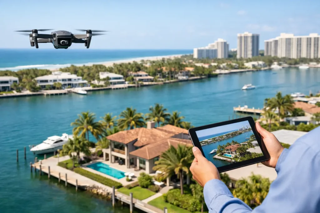
A ground-level photo can show a beautiful kitchen. It cannot show that the kitchen opens to a waterfront patio, sits minutes from a marina, or belongs to a home with a rare oversized lot. In South Florida, where views, proximity, outdoor living, and neighborhood context shape buyer decisions, that missing perspective matters. That is why use drone photos for listings is more than a visual question. It is a marketing decision that can help buyers understand the property faster and give your listing a stronger first impression.
Why Use Drone Photos for Listings?
Drone photography gives buyers the perspective they cannot get during a quick scroll through MLS results. It shows the full footprint of a property, the relationship between the home and its surroundings, and the lifestyle features that make a location valuable. For agents competing in Miami-Dade, Broward, and Palm Beach, that context can be the difference between another listing image and a listing that earns a click.
The strongest aerial images do not simply show a roof from above. They answer questions buyers already have: How private is the backyard? How close is the beach, park, golf course, or downtown district? Is there a dock, pool, guest house, or expansive outdoor entertaining area? Does the home sit on a corner, a canal, a lake, or a large parcel that is difficult to understand from street level?
When the answers are visible immediately, buyers arrive at the listing with a clearer reason to keep looking. That can improve the quality of inquiries and reduce showings from people who never understood what the property offered.
Aerial Images Put Property Scale in Context
Luxury homes are not the only properties that benefit from aerial photography. Aerials help any listing where the land, setting, access, or nearby amenities add real value. A townhome near a walkable retail district, a single-family home with a deep backyard, or a condo beside the Intracoastal can all benefit from the right elevated image.
At ground level, wide-angle photography can make a space feel open, but it cannot accurately communicate how much space sits around the building. Aerial photos establish scale. They can show the size of the lot, driveway capacity, landscaping, roofline, pool placement, and the separation between neighboring homes. For properties with acreage, waterfront frontage, or multiple structures, this is often essential rather than optional.
That visual clarity supports your pricing story. If a buyer can see the usable yard, the canal access, or the distance between homes, the value proposition becomes easier to understand before they ever schedule a tour.
Location Is Part of the Listing
In South Florida real estate, location often sells the home before buyers review the interior details. They may be shopping for boating access, ocean proximity, a gated community, a school zone, a golf lifestyle, or a short commute to a major business district. Standard listing photography cannot always communicate those advantages without relying on a caption.
A well-planned drone photo can place the property within its real-world setting. It can frame a home against the water, show the nearby coastline, identify a community amenity, or reveal a peaceful greenbelt behind the yard. The point is not to make the property look isolated from reality. It is to show the features that make its position desirable.
This is especially valuable for out-of-area and relocating buyers. They may know the neighborhood name but have no feel for the street, surrounding landscape, or nearby attractions. Aerial visuals give them orientation quickly, helping your listing work like a 24/7 open house for people browsing from another city or state.
Better Visual Marketing Across Every Listing Channel
Drone photos have value beyond the MLS gallery. One thoughtful aerial session can create assets for property websites, social posts, email campaigns, paid advertising, listing presentations, and short-form video. Agents need content that works in more than one place, and aerial imagery provides a high-impact visual anchor for the broader campaign.
The first image in a carousel needs to stop the scroll. A dramatic but accurate overhead view of a waterfront property, private pool, or large lot can do that. Aerial footage can also create a strong opening for a property reel, then transition into interiors, amenities, and a clear call to schedule a showing.
For brokerages and agents, the benefit is also professional positioning. Consistent drone photography signals that you market homes deliberately, not minimally. Sellers notice the difference when comparing agents. Showing an aerial strategy in a listing presentation can demonstrate how you will present their home at its highest perceived value, particularly when the outdoor setting is a major part of the sale.
When Drone Photography Makes the Biggest Difference
Not every listing needs a large collection of aerial photos. A compact condo with no meaningful exterior feature may be better served by exceptional interior photography, a detailed floor plan, and a virtual tour. Drone capture should be purposeful, not added simply because it is available.
It has the greatest impact when the aerial view reveals something buyers would otherwise miss. That often includes waterfront homes, properties near beaches or parks, residences in golf communities, homes with large lots, estates with extensive landscaping, new construction, properties with rooftop spaces, and listings close to major lifestyle destinations.
Drone photos are also useful for properties where access or layout is hard to explain. A home on a quiet cul-de-sac, a residence with a long private drive, or a property with a detached guest suite can become easier to evaluate when buyers see the full arrangement from above.
The trade-off is simple: aerial images should add clarity, not clutter. If the flight cannot safely and legally produce an image that strengthens the story, invest those marketing dollars in the visual assets that will. Great listing media is not about checking every box. It is about choosing the right tools for the home.
Professional Capture Protects the Listing and the Brand
Drone photography is not a job for casual experimentation. Airspace restrictions, weather, privacy considerations, local conditions, and FAA requirements all affect what can be captured and when. South Florida also presents practical variables, including high winds, sudden rain, dense development, and controlled airspace near airports.
A professional drone operator plans around those conditions. They know how to select angles that flatter the property without misrepresenting it, when to schedule for clean light, and how to avoid visual distractions such as harsh shadows, busy roads, or construction activity. Just as important, they understand that a beautiful aerial image still has to be accurate.
Accuracy builds trust. Overly edited water colors, misleading proximity shots, or images that imply an amenity belongs to the property when it does not can create disappointment later. The goal is to show the possibilities and the actual setting with polish, not to manufacture a story buyers will question at the showing.
Professional editing also matters. The final gallery should feel cohesive with the interior photography. Exposure, color, framing, and image order should guide buyers naturally from the big picture to the details. An aerial image is most effective when it feels like part of a complete marketing system, alongside high-quality photos, video, floor plans, and virtual tours.
Turn the Aerial View Into a Stronger Listing Story
The best drone strategy starts before the flight. Think about what the buyer needs to understand in the first 30 seconds. Is the home selling a water view, privacy, a resort-style backyard, walkability, or an unusually large parcel? Identify that message first, then capture the images that prove it.
For a waterfront home, the strongest sequence may begin with an elevated hero image, followed by an angle that shows the dock and water access, then ground-level photos that bring the pool and entertaining space to life. For a suburban property, the aerial may establish lot size and proximity to a park, while interior photography carries the rest of the narrative.
This approach makes your marketing more intentional. Instead of adding drone photos at the end, you use them to frame the listing from the start. That gives buyers a faster understanding of what makes the property different and gives sellers a clear view of the work behind the campaign.
A well-produced aerial image does not replace strong real estate photography. It makes the entire presentation more complete. When the property has a location, layout, or lifestyle advantage worth seeing from above, give buyers that perspective before they decide whether to move on to the next listing.